![Preparing to Direct Your First Field Project or Field School [Foundational Skills]](https://images.saa.org/container/images/default-source/img-careerpractice/fieldsurvey_overlay.tmb-seminar.png?sfvrsn=f2c58c39_1)
Registration Closed!
Preparing to Direct Your First Field Project or Field School [Foundational Skills]
When: November 05, 2025 3:00-4:00 PM ET
Duration: 1 hour
Certification: RPA-Certified
Pricing
Individual Registration: Free to SAA members; $69 for non-members
Group Registration: Free to SAA members; $89 for non-members
Dr. Kaitlyn Davis was the lead author on a publication in Advances in Archaeological Practice’s 2021 special issue on Health and Wellness in Archaeology, specifically focusing on safety considerations for first time field directors (such as graduate students). She also co-led a well-attended SAA seminar in 2022 on safety and logistical considerations for preparing a first field project. She teaches one of Northern Arizona University's archaeological field schools.
Dr. Davis is an archaeologist with over 10 years of experience including cultural resource management, community collaboration, public lands management, and academic research. She is interested in community-based archaeology, public archaeology, artifact sourcing, paleoethnobotany, geoarchaeology, and landscape archaeology. She especially values community-based collaborative archaeology, having worked in cooperation with community members from the Confederated Salish-Kootenai Tribes, the Nez Perce (Nimiipuu) Tribe, the Santa Fe South Cooperative Association, the Friends of Fort Owen, the Ute Mountain Ute Tribe, and Ute Indian Tribe, and collaborating for 11 years with the Pueblo of Pojoaque. She has completed archaeological projects for the Forest Service, Bureau of Land Management, National Parks Service, New Mexico State Land Office, Archaeological Conservancy, and Montana State Parks. She has previously worked in several midwestern and western states and Ireland, and at archaeological sites ranging in date from the early archaic period through the early twentieth century. She has supervised the crews and planned the logistics for multiple of the projects previously described. These crews have ranged from volunteers of all ages and experience levels to university and federal employees. She earned her PhD from the University of Colorado in 2022 and is currently an Assistant Professor of Archaeology at Northern Arizona University and a Senior Archaeologist at Chronicle Heritage.
The resources and recommendations provided in this seminar will be especially useful for projects whose crews are comprised at least partially of students, interns, or volunteers (such as Passport in Time, university, or nonprofit-sponsored projects).
2. Provide information to share with your crew (e.g. acknowledgement of risk form, code of conduct agreement, info packet).
3. Learning things to keep in mind when structuring your project (i.e. structuring a safe project).
![Job Options in Archaeology and Heritage Management [Career Pathways]](/images/default-source/default-library/job-options-in-archaeology-and-heritage-management-(1).tmb-seminar.png?Culture=en&sfvrsn=7994cca5_1)
Registration Closed!
Job Options in Archaeology and Heritage Management [Career Pathways]
When: October 29, 2025 3:00-4:30 PM ET
Duration: 1 hours
Certification: None
Pricing
Individual Registration: Free to SAA members; Not available to non-members.
Group Registration:
- Each breakout room will be capped at 40 people per room.
- Registrants will receive a confirmation email immediately, an email with log in information about one week before the event, and a reminder email the day before. If you do not receive the automated confirmation email, please double-check that you have completed registration.
- This event is FREE to SAA members and not available to non-members.
![Como nominar alguien para un premio de la SAA [Foundational Skills]](/images/default-source/default-library/spanish-awards-seminar.tmb-seminar.png?Culture=en&sfvrsn=2fe5b2d2_1)
Registration Closed!
Como nominar alguien para un premio de la SAA [Foundational Skills]
When: October 16, 2025 3:00-4:00 PM ET
Duration: 1 hour
Certification: None
Pricing
Individual Registration: Free to SAA members; free for non-members
Group Registration: Free to SAA members; free for non-members
Dan Sandweiss es un arqueólogo andinista con casi 50 años de experience en la América Latina. Ha participado en comités de selección para premios de la SAA y hizo una nominación exitosa para un premio. Fue el presidente de la SAA de 2022 a 2025 y ortorgó los premios de la SAA a los ganadores cada año.
2. Saber como extraer la información clave de las convocatorias para nominaciones para premios
3. Saber como escribir una nominación para un premio
![Cemetery Site Protections and Cultural Resource Management: A View from Louisiana and Implications for the Rest of the United States [Deeper Digs]](/images/default-source/default-library/cemetery-1.tmb-seminar.png?Culture=en&sfvrsn=d6a677ba_1)
Registration Closed!
Cemetery Site Protections and Cultural Resource Management: A View from Louisiana and Implications for the Rest of the United States [Deeper Digs]
When: October 09, 2025 2:00-4:00 PM ET
Duration: 2 hours
Certification: RPA-Certified, Louisiana State Bar Association MCLE
Pricing
Individual Registration: Individual Registration: $99 for SAA members; $149 for non-members
Group Registration: Group Registration: $139 for SAA members; $189 for non-members
Ryan has been studying cemeteries and biological anthropology for over 30 years. He holds a BA (Florida State) and an MA (Louisiana State) in anthropology and a Ph.D. (Univ. of New Orleans) in urban studies/urban anthropology. Ryan also holds two law degrees (Louisiana State) and has been a licensed lawyer for over 20 years (Louisiana and Vermont). Ryan's legal, anthropological, and academic pursuits have been guided by studying the intersections of law and archaeology, including historic and archaeological preservation, human remains law, and shipwreck law. As a lawyer for the State of Louisiana for 20 years, Ryan policed the illicit trade in human remains in that state and collaborated with other states and federal agencies engaged in such endeavors. At the same time, Ryan authored or coauthored the laws that today make Louisiana's cemetery site protections the strongest in the United States. In addition, Ryan regularly teaches CRM, historic preservation, property law, and the anthropology of death and burial through adjunct appointments at the University of New Orleans, Southern University Law Center, and Arizona State University.
2. Provide guidance for how these laws interact with the basic practice of CRM in the U.S.
3. Provide guidance for working to improve protections of these sites in jurisdictions around the U.S.
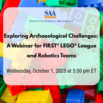
Registration Closed!
Exploring Archaeological Challenges: A Webinar for FIRST® LEGO® League and Robotics Teams
When: October 01, 2025 5:00-6:00 PM ET
Duration: 1 hour
Certification: None
Pricing
Individual Registration: Free to SAA members; Free for non-members
Group Registration: Free to SAA members; Free for non-members
Elizabeth Reetz, Strategic Initiatives Director, University of Iowa Office of the State Archaeologist. Formerly a Cultural Resources Management fieldwork director, Elizabeth now focuses on archaeology education, communications, and making archaeology accessible to all ages.
Mary De La Garza, Research Technology Director, University of Iowa Office of the State Archaeologist. Mary is a Systems Administrator who uses her technical skills in the digital archaeological realm. She is a licensed drone pilot and produces and analyzes aerial lidar and thermal data collected from archaeological sites by a UAS.
Ervan Garrison, Professor Emeritus, Geology & Anthropology, University of Georgia. Ervan currently conducts geoarchaeological research using drone and ROV-hosted geophysical sensors.
This webinar is designed for those participating in the 2025-2026 FIRST® LEGO® League UNEARTHEDTM season focused on archaeology. Our expert panelists will discuss the various challenges archaeologists face with logistics, research, excavation, fieldwork, artifact analysis, storage, and more! We'll address common questions that archaeologists receive and will answer questions from attendees. Coaches and students are invited to attend, but an adult must be the one to register on behalf of their team. No matter what point your team is in preparations, this session will help you brainstorm the ways that new innovations can address real-world archaeological challenges.
The webinar was recorded and can be found here: Exploring Archaeological Challenges: A Webinar for FIRST® LEGO® League and Robotics Teams - YouTube